Table of contents
Effective coordination between New Jersey school districts and their local communities has never been more critical.
From everyday maintenance and event planning to emergency preparedness and response, seamless collaboration among district staff, first responders, and municipal partners is essential. Creating better integration among a school district and other public officials ensures safety and smooth operations.
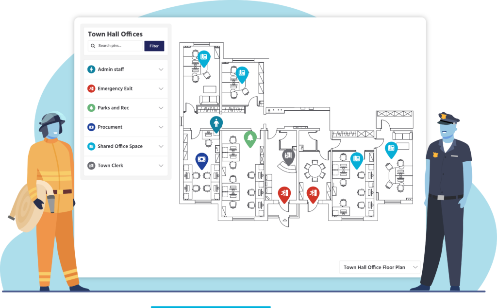
Interactive mapping is one of the most potent tools helping districts across New Jersey enhance this coordination. This digital, real-time, and dynamic solution visually represents school campuses, assets, and critical safety information in one centralized platform.
Why coordination matters for New Jersey school districts
Schools present unique challenges for emergency responders and community partners. Due to their size, complexity of campuses, and population they serve, emergency personnel need to access information to help ensure they remain safe. This should be conveyed through comprehensive, clear, and easily accessible information.
Solutions like interactive mapping help emergency personnel respond quickly and effectively in crisis situations.
Schoolsmark entrances with a first responder numbering system and ensure that each facility provides detailed emergency information like:
- Emergency shut offs
- HVAC and mechanical systems
- Overall floor and roof plan
- Fire safety systems
- Emergency equipment locations
- Security protocols
- Views of the surrounding area
This readily available, detailed data is critical to first responders who often arrive at unfamiliar, complex environments during high-pressure incidents.
What is interactive mapping, and why does it matter?
Interactive mapping offers more than traditional paper blueprints. It’s a dynamic, constantly updated map. This feature allows users to visualize detailed layouts of school campuses, classrooms, hallways, exits, safety equipment, and hazard zones.
Key capabilities include:
- Real-time updates reflecting renovations, safety protocol changes, or emergency information
- Pinned locations in critical areas like exit doors, assembly points, security cameras, fire extinguishers, emergency shut-offs, and hazardous materials locations
- Mobile access that enables staff and first responders to access maps via tablets, phones, or computers on the go
This makes interactive maps a critical resource that supports day-to-day operations, safety inspections, and emergency response.
Enhancing school safety through interactive mapping
Since coordination among New Jersey public services is critical, districts that implement interactive mapping benefit from enhanced coordination and safety. Here is how they benefit:
Improved emergency response times
During emergencies, every second counts. Interactive maps provide first responders and school personnel with clear, up-to-date building and property visualizations, enabling them to:
- Locate emergencies quickly and accurately
- Identify locked or restricted areas
- Find emergency shutoffs and safety equipment
- Navigate evacuation routes efficiently
Increased collaboration with first responders
Interactive mapping facilitates incident planning. Law enforcement, fire departments, and emergency medical teams can familiarize themselves with school layouts, security measures, and emergency protocols before a crisis occurs.
Detailed evacuation planning and drills
Schools can tailor evacuation plans with interactive mapping for fires, severe weather, or security threats. Administrators can mark multiple evacuation routes, assembly points, and safe zones. This will ensure drills are thorough and realistic.
Centralized safety and operational data hub
Beyond emergency use, interactive maps serve as a central repository for all facility-related data, including:
- Work order locations
- Hazard areas needing remediation (e.g., asbestos zones)
- Event planning and logistics
- Infrastructure and asset inventories
This centralized information streamlines communication and operational coordination across departments and with external partners.
Real-world impact: Coordination that saves time and lives
Imagine a scenario where a gas leak is reported near a middle school. With interactive mapping, the facilities team can immediately identify the gas shutoff valve location, mark off hazard zones on the map, and share this data instantly with emergency responders and school administrators.
Buses can be rerouted using marked alternate entrances, and emergency teams arrive informed about building layouts and potential risks, enabling a swift, coordinated response that protects students, staff, and the community.
Why interactive mapping is a must-have for modern school districts
In an era when school safety is paramount and operational complexity grows, districts cannot rely on static maps or siloed information systems. Interactive mapping provides a single source of truth—one platform accessible to all stakeholders for real-time, actionable insights.
By adopting interactive mapping technology, your district can:
- Enhance communication and coordination with local first responders and community partners
- Improve response times and safety outcomes during emergencies
- Streamline routine operations and event management
- Support capital planning and infrastructure management with accurate data
Learn more and get started today
Ready to see how interactive mapping can transform your district’s community coordination and safety?
Reach out to FMX to schedule a demo and see how we can help your school system.
Written by
Zach Jones
Content Manager at FMX
